You are here: Explore > Newquay Discovery Trail
Newquay Discovery Trail
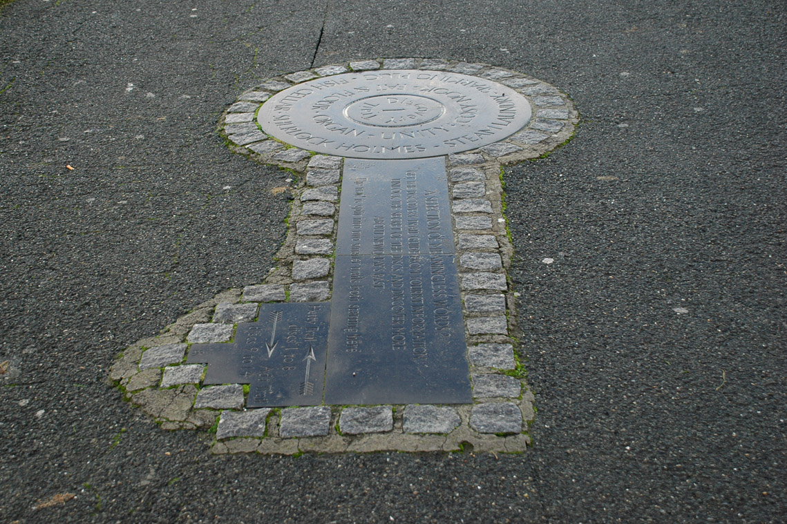
Unlock the secrets of Newquay's past! Walking the Newquay Discovery Trail you will find slate discs, about a metre (1 yard) in diameter, embedded in the ground at key places of interest. Each slate circle is numbered and these link in with the map so you can read fascinating facts about your location whilst taking in some spectacular views - a great way to enjoy a tour of Newquay without a car.

There are two seperate walks, the 'Hetty’ and the 'Ada’ that make up the entire Discovery Trail. The 'Hetty', yellow on the map, takes a mostly coastal route including the beautiful Harbour, the 'House on the Island' and Fistral Beach. The 'Ada', pink on the map, takes in some of the coast but then moves inland passing through the Trenance Leisure Park, Gardens & Boating lake and near to a number of popular Newquay attractions including the Zoo, Waterworld and the Tennis centre.
The Discovery Trail Map itself has many more facinating facts and infomation on it - this website is just a brief overview. To get your copy of the Discovery Trail Map call into the Visit Newquay Tourist Information Centre on Marcus Hill or order your copy by Tel: 01637 838516 or by email: newquay.tic@newquay.town. Just £2.00 + P&P.
Newquay Discovery Trail Personal Audio Tour

The fun and informative Newquay Discovery Trail has now added an audio version, the personal tour. Available through the Geotourist app the information associated with each Discovery Trail Stone is now narrated to you at each location. This adds a whole new dimension to the experience as if you have your very own personal guide with you and all of you on the walk can listen in.
To experience the Newquay Discovery Trail Personal Audio Tour either use the QR code below or CLICK HERE
Alternatively, you can download the Geotourist App from your App store and once installed lookup 'Newquay Discovery Trail' to enjoy the audio experience.

Follow the 'Hetty' & 'Ada' Discovery Trails walks
Why 'Hetty' and 'Ada' you may ask? Newquay Harbour played a major part in defining the town's role in Cornwall for hundreds of years, but by the late 1920's Newquay was becoming a popular holiday destination and the commercial harbour was becoming less important. 'The Hetty' and 'the Ada' were the last ever, fully laden, Schooners to use the Harbour and symbolise an end of the era who's legacy you will uncover on the Discovery Trail walk. Whilst the Newquay of today is now known for beach holidays and surfing, following the Discovery Trail reveals Newquay's past with picturesque locations steeped in history - from the iconic 'House on the Island' to the Trenance Gardens and Boating lake overlooked by the impressive Viaduct.
Start your exploration of Newquay's history!
It all starts with the 'keystone' (above), listed as number one on the map. Located at the heart of Newquay on a grassed area called the Killacourt and overlooking Towan Beach just a few minutes walk from the Newquay Tourist Information Centre; it's a good place to start for either of the two walking trails.
Stand by slate Disc 1 and you can see one of Newquay towns most iconic views, the House on Newquay Island - also known as Towan Island. There has been a dwelling there since the turn of the Twentieth century and the early residents have had some famous visitors over the years - possibly even including Sir Arthur Conan Doyle. Prior to the first human dwelling the only regular occupants were chickens in a hen house. At this time, the island could only be reached by a 'retractable' wooden & rope bridge so the birds and their eggs were well protected against all but most determined rock climbing predator - but probably not the seagulls. It is currently used as a holiday apartment but over the years it has been a cafe, the home of a Lord & Lady and the residency of a gentleman who regularly played his grand pipe organ so that it could be heard across the bay of an evening.
The House on the Island

The Hetty Trail: Disc's 2 to 8 (approximately 1 1/2hrs)
Walking this trail takes you next past Disc 2 one of the oldest areas of Newquay, Fore Street overlooking the Harbour. If you look closely at the buildings there you can see the original stone built houses - a mix of fisherman cottages and small businesses of the time, from lobsterpot and fishing net makers to the butcher, baker and candlestick maker. Some of the terraced houses, except for some modern additions, are very similar to what they would have looked like at the peak of the fishing industry well over a century ago.
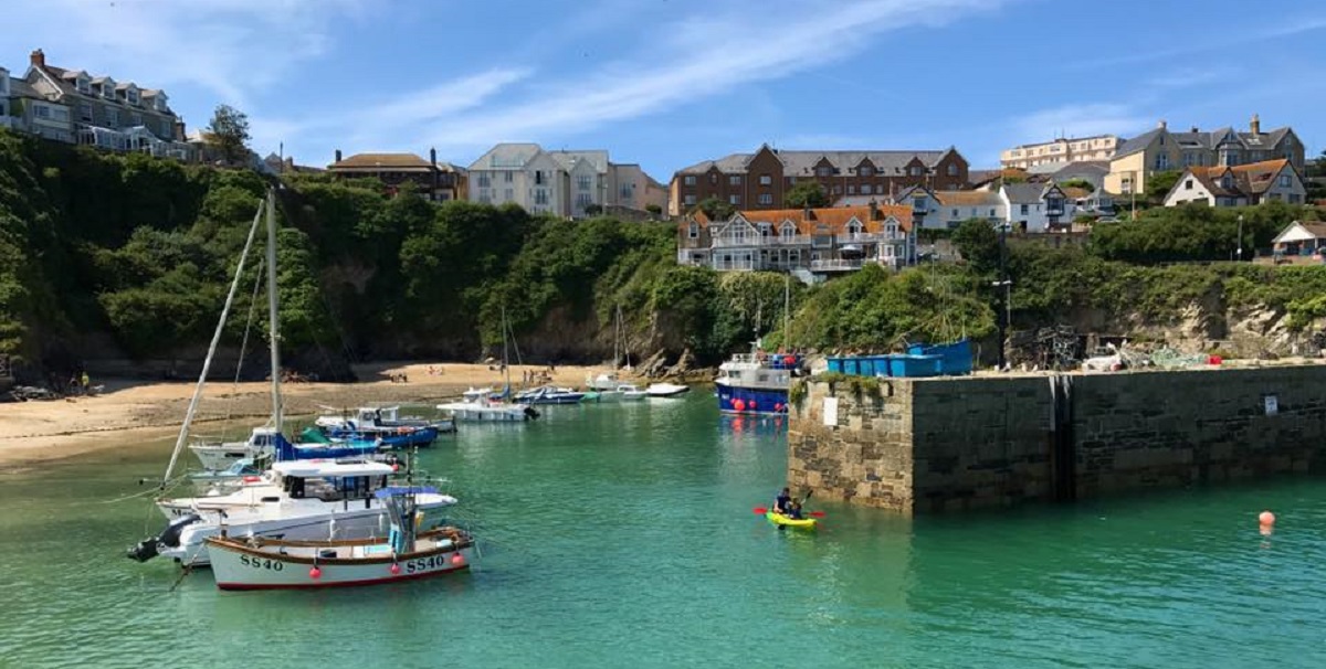
Disc 3 is at Newquay Harbour. Today there is some small scale commercial fishing but nothing compared to the heyday of landing industrial sized quantities of fish - in particular, the pilchard (sardine). Several companies offer fishing trips so you can experience a little of that feeling of catching your own supper. Read much more about its history from your copy of the Discovery Trail Map and aim to spend a fair amount of time their whilst on your walk.
Newquay Harbour
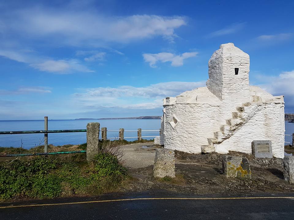
As you continue walking the Hetty Trail you visit the Huer's Hut (Disc 4), an old lookout shelter for the 'Huer' who would call out to Newquay when the shoals of pilchards entered the bay. Every available fishermen would rush to their boats and try to catch the bounty.
Huer's Hut
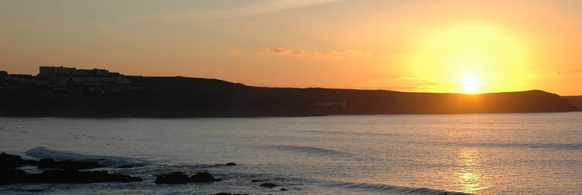
Next, you reach the small peninsula of Towan Head (Disc 5) and pass by the old Lifeboat station. Here, you are rewarded with spectacular views over the Atlantic ocean as well as a panoramic vista of Newquay Bay looking Northward to Watergate Bay and beyond or Southward over the iconic Fistral Beach.
Towan Head
Walking Westward towards Fistral Beach from Towan Head you can’t miss one of our most striking buildings – the Headland Hotel (Disc 6). This spectacular looking hotel dates back to the turn of the 20th Century and in 1911, Edward Prince of Wales, stayed there. On a slightly more contemporary note, the Beatles visited it as part of their 1960’s ‘Magical Mystery Tour’ and the 1990 film version of Roald Dahl’s ‘The Witches’ had scenes filmed there.
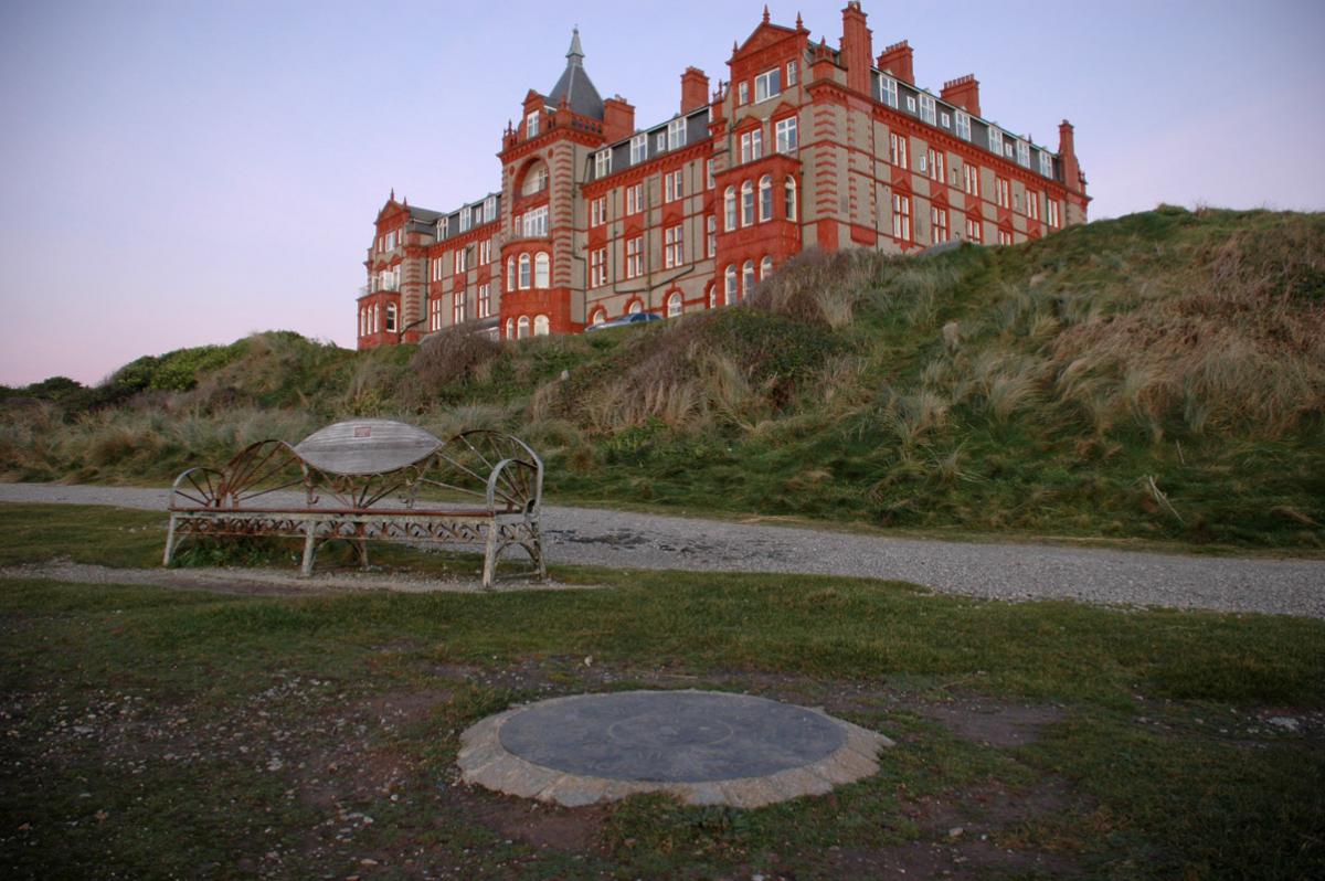
You now start your return journey to the Killacourt via the Golf Club and Hope Terrace (Disc 7) and Crantock Street (Disc 8) passing through the centre of Newquay and soon you are back overlooking the Island.
The Ada Trail: Disc’s 9 -14 (approximately 2hrs)
Your first destination from the keystone is the Railway Station (Disc 9). Now a favourite way of reaching Newquay for a visit this branch line was once a critical part of distributing the days fishing catch. Once linked by tram to the Harbour the boatloads of fish could be whisked away to their destination throughout the UK – and beyond - as fast as the then steam trains could go.
Moving on takes you to the Barrowfield (Disc 10). This large grassy area, overlooking the ocean, is popular for walking dogs (the cliffs are fenced off) and hosts various events throughout the year. It gets its name from the ancient Bronze Age burial ‘Barrows’, or 'Tumuli' that were once there. Next stop is the Tolcarne Cross (Disc 11) enroute to our hidden gem Trenance Gardens & Boating lake (Disc 12). There is a great deal to see and do in this little valley. The Gardens and Lake (you can hire boats in the season) are a beautiful place to stop for a while. The old Trenance cottages have been restored and are now a museum with a little tea room attached - after all that walking there's nothing nicer than a Cornish cream tea. Just over the road from the gardens is the Trenance Leisure park with the Zoo, Water park, Tennis centre and play area. Certainly a great place to visit again after you have completed your walk.
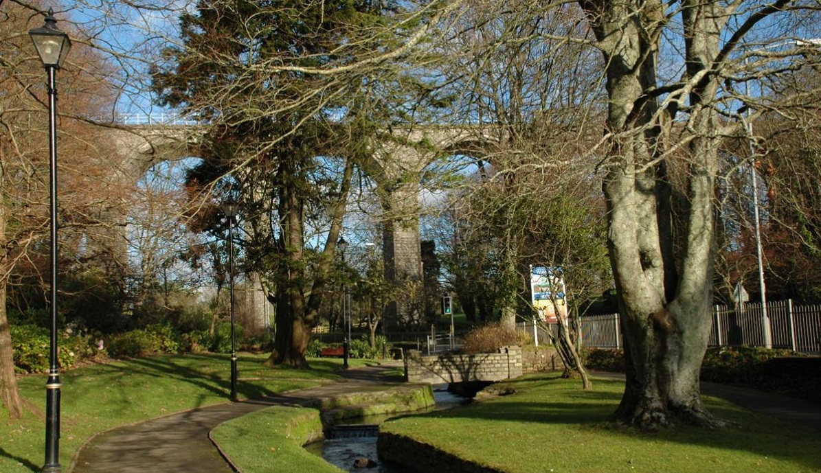
As you pass by the end of the boating lake and then cross the road the River Gannel Estuary (Disc 13) greets you. This was the last resting place of the Ada (the Schooner this trail is named after) which survived until 1951 until a fire gave her to the sea. The Gannel was almost as important to Newquay as the Harbour, with cargo carrying Schooners & Lighters, moorings and even a shipyard. However, over time, the estuary silted up and only smaller craft (and generally only pleasure craft) could negotiate the river by the mid 18th Century. As you walk along the river bank listen out for an eerie sound – this is the sound of the Crake, a troubled spirit, that apparently haunts the area.
Gannel Estuary
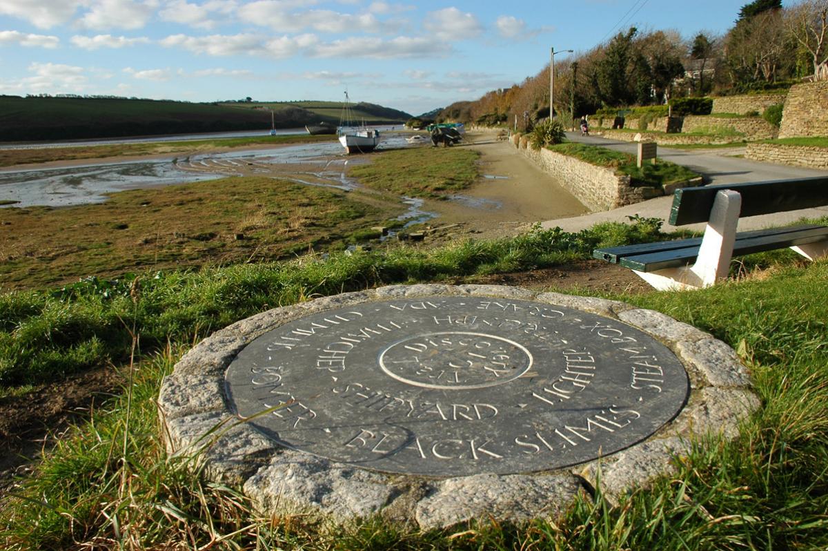
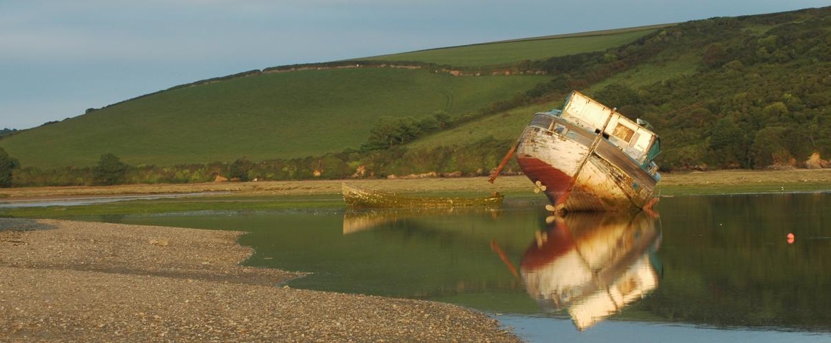
Finally, you are on your last leg to return to the that keystone at beginning of the trail by walking through Mount Wise & down Marcus Hill (Disc 14). Mount Wise has several historical secrets there is now no sign of, from 1790 to 1860 there was a large silver mine there and, somewhat strangely by today's standards, an associated Water works that continuously drained the mine and supplied that water to the town. At the end of Mount Wise you turn left into Marcus hill, there on the corner is the imposing St Michaels Church.
Once on Marcus Hill you will find the Visit Newquay Tourist Information Centre where you discover what else you can do in, and around Newquay.
Remember, the Discovery Trail Map itself has far more facinating facts and infomation on it than this website. To get your copy of the Discovery trail walk with more information about the various locations just call into the Visit Newquay Tourist Information Centre in the Library on Marcus Hill or order your copy via Tel: 01637 838516 or newquay.tic@newquay.gov.uk - £2.00 + P&P


.png)


